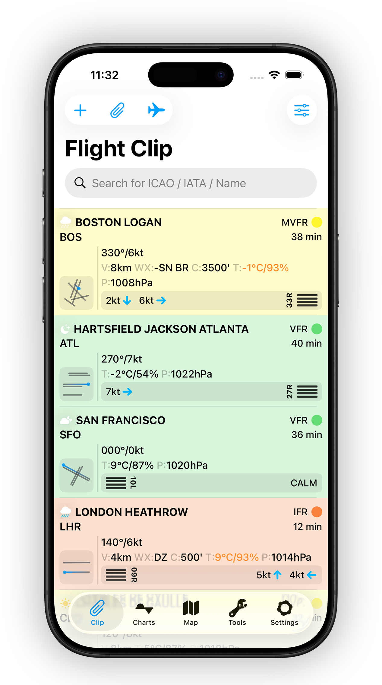
Decoded METAR & TAF
Read every report in a fully decoded, human-readable format. Understand conditions at a glance without interpreting raw data.
METAR, TAF, NOTAMs, D-ATIS, radar and maps — StationWeather turns raw aviation weather into clear, visual information, so you spend less time decoding and more time deciding.
StationWeather pulls every source a pilot needs and turns raw aviation data into clear, actionable insight.
Read every report in a fully decoded, human-readable format. Understand conditions at a glance without interpreting raw data.
See the complete forecast on a visual timeline. Watch wind, visibility and conditions evolve at any given time — instantly.
StationWeather reads your roster from the device calendar, detects departure, destination and times, and pulls the right weather automatically.
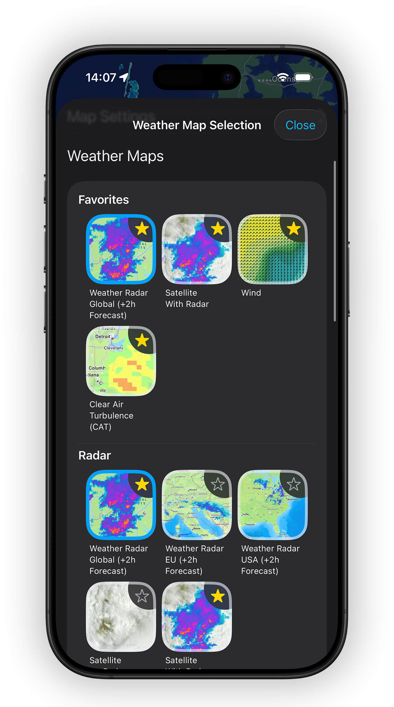
Overlay your route on interactive weather maps — radar, turbulence, cloud tops, wind and pressure along your exact path, at the times that matter.
Filter, sort and colour-code NOTAMs by relevance, with full-text search and filters fully customisable for your specific operation.
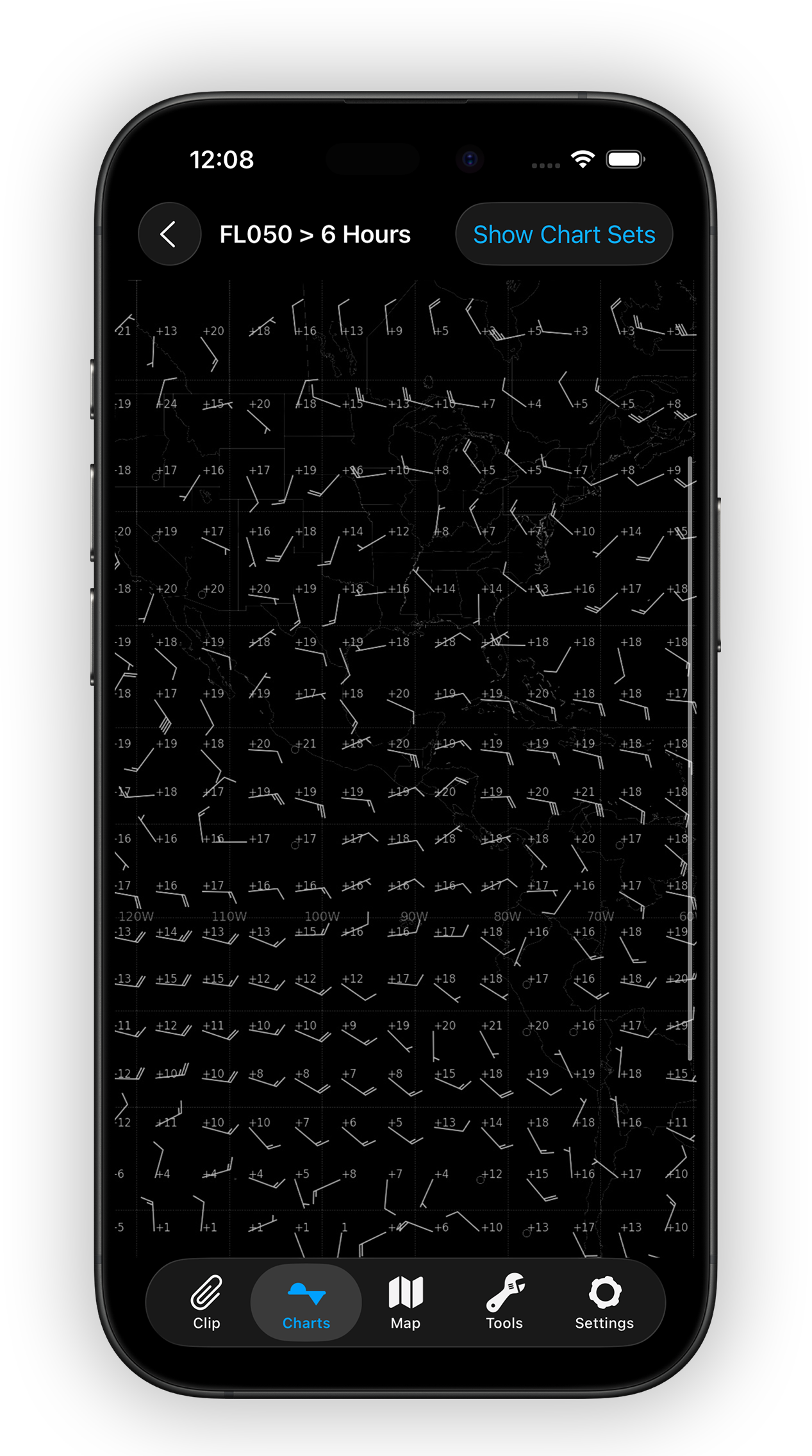
Browse over 700 aviation weather charts across every ICAO region, including significant weather (SIGWX) charts.
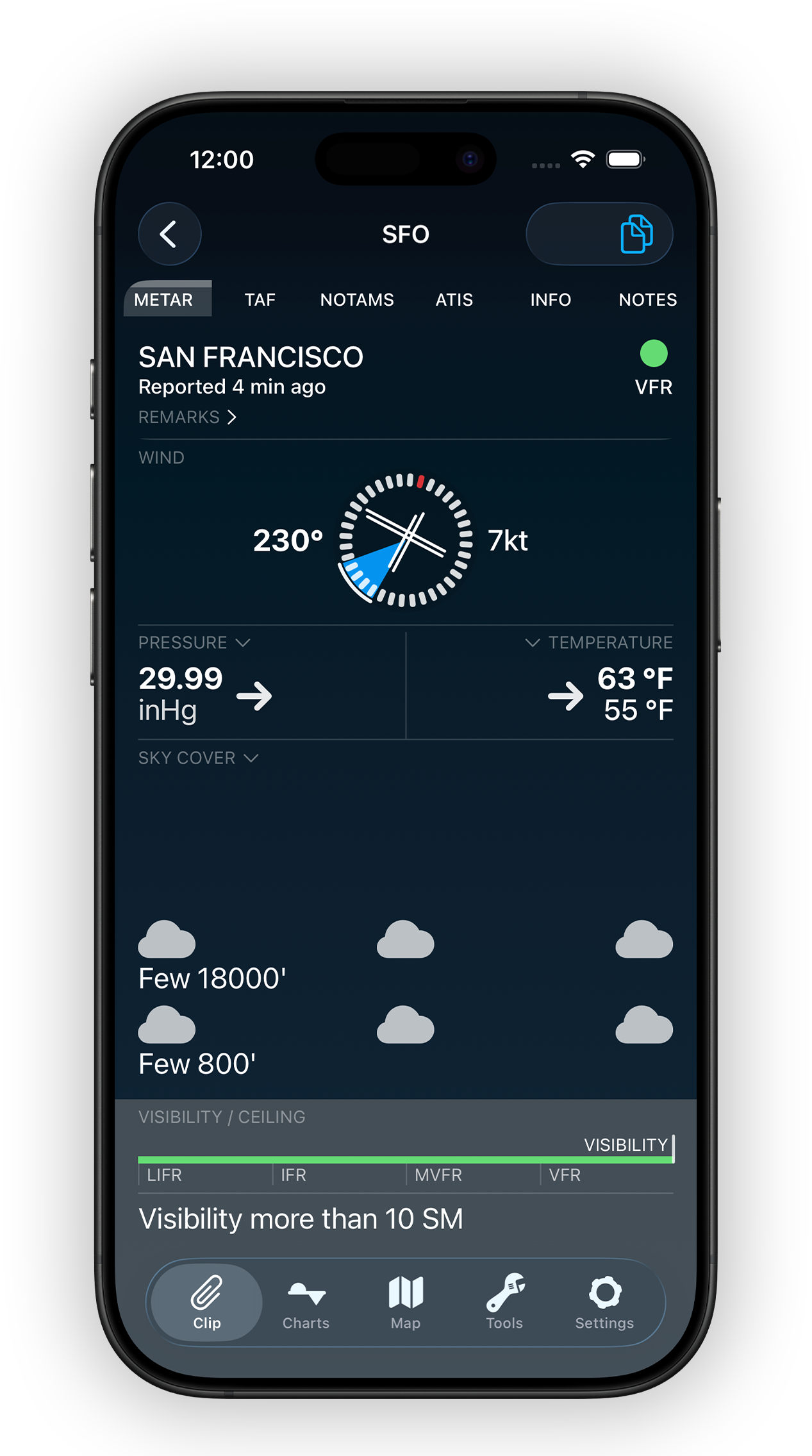
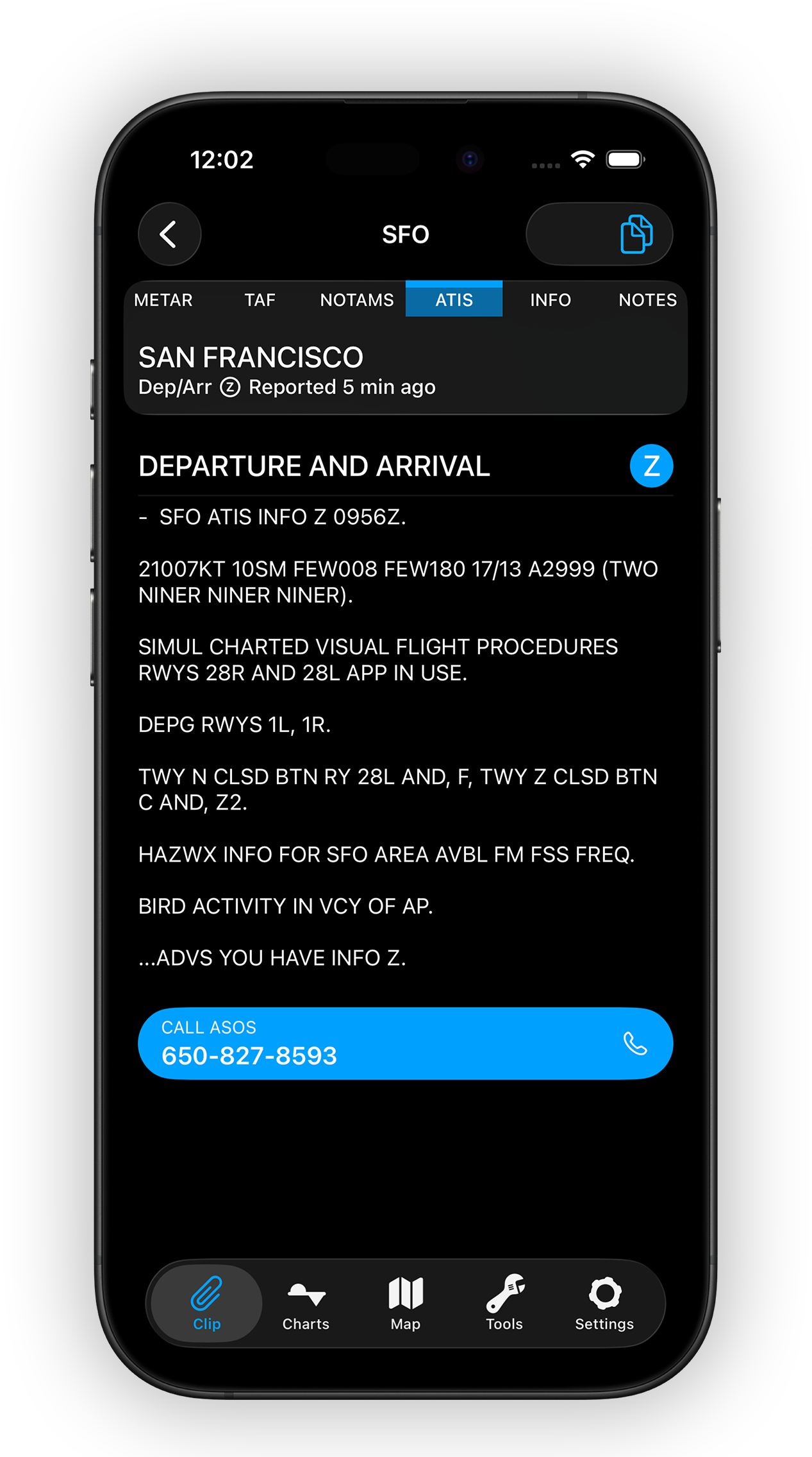
Tap any airport for a completely decoded METAR — no matter how long the raw report is. See an actual wind indication over a runway layout and get more insight, faster.
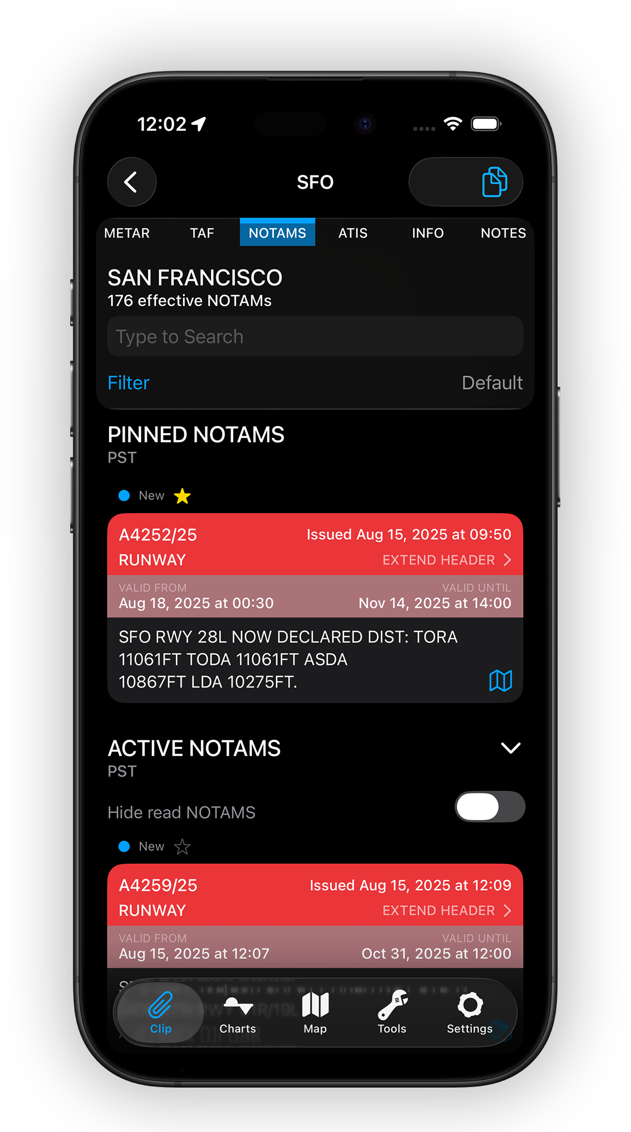
NOTAMs arrive sorted, filtered and colour-coded by relevance. Search the full text and build fully customisable filters tailored to your specific operation.
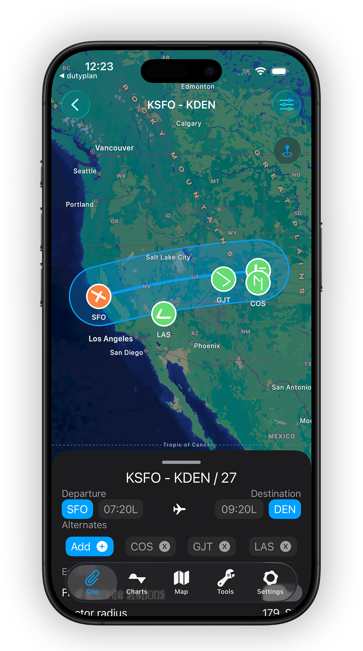
Overlay your flight route on interactive weather maps to view radar, turbulence, cloud tops, wind and pressure along your exact path. Look up any of 40,000+ stations and link nearby ones when direct data isn’t available.
Clean, glanceable and built around the decisions pilots actually make.
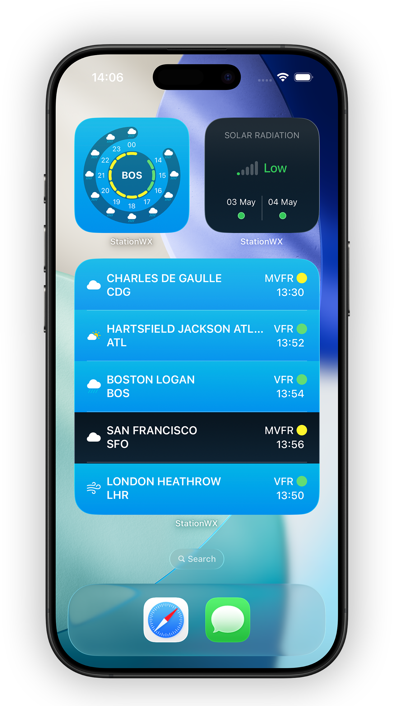
Put key weather data right on your Home and Lock Screen. Widgets, Live Activities and Apple Watch complications keep you updated throughout your flight day — including a 3-day solar radiation risk forecast for high-altitude operations.
Yes — StationWeather is free to download and use. An optional Pro subscription unlocks advanced features such as animated weather radar, Home Screen widgets, Apple Watch and live D-ATIS, and you can try it free of charge.
StationWeather is a native app for iPhone, iPad, Mac and Apple Watch, available on the Apple App Store.
Yes. StationWeather reads your roster or flight schedule from your device calendar, detects departure, destination and flight times, pulls the right weather for each airport, and selects suitable alternates along the route.
METAR, TAF, NOTAMs, D-ATIS, worldwide weather radar, more than 700 weather charts for every ICAO region, and over 40,000 weather stations.
StationWeather is hard to beat for quickly checking multiple METARs and TAFs in a clean, visual format. Favorite airports can be grouped and compared side-by-side, making it especially useful when evaluating alternates or tracking weather trends across a region. It also does a nice job visualizing forecast changes, helping you quickly see when conditions are expected to improve or deteriorate. With a Pro subscription, you can even display multiple airport METARs on iPad widgets for quick reference.— iPad Pilot News, “The 10 Best Weather Apps for Pilots” (2026) · Read the review →
Start a whole new preflight briefing experience — for free. Download StationWeather and test every Pro feature at no cost.